Closing date: 27 November 2022
St Helens council has launched a survey on its new ten-year strategy which will set out its priorities for investment in walking and cycling infrastructure across St Helens Borough.

Closing date: 27 November 2022
St Helens council has launched a survey on its new ten-year strategy which will set out its priorities for investment in walking and cycling infrastructure across St Helens Borough.
Closing date Friday 9 September 2022
Liverpool City Council is asking the public for their feedback on the proposed permanent lanes, which are located on the following routes:
• East Lancashire Road to the city centre – from Norris Green to Breck Road and on to Everton Park.
• Gateacre to the city centre – connecting up the university campuses through to the Knowledge Quarter.
• Sefton Park to the city centre – connecting the Ropewalks to Baltic Triangle and on to Dingle and Aigburth.
Full information and survey at: www.liverpool.gov.uk/consultation
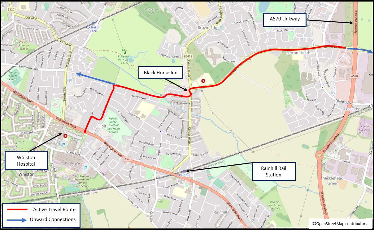
St Helens Borough Council is currently seeking views on early-stage plans for two new routes – deadline 12th August 2022:
• Jubits Lane, between Sutton Manor and A57 Warrington Road. Extending routes installed in 2020, when completed this route would provide connectivity between St Helens, Marshall’s Cross, Sutton Manor, and Widnes.
• Lea Green to Whiston, extending planned routes from St Helens and Lea Green Station beyond the A570 St Helens Linkway towards Whiston Hospital, a major local employment site.
The proposals include the provision of high-quality, dedicated facilities for people travelling on foot and by bike, within the existing highway corridor.
These proposals are at an early stage of design, with no implementation funding or delivery timescales currently secured.
Detail on the proposals, frequently asked questions and information on drop in/online workshops, are also available at
https://www.sthelens.gov.uk/activetravel
From this page, you will be able to complete a brief survey, to share your thoughts on the proposals. Deadline – 12th August 2022. The final scheme will be subject to further engagement and a full public consultation process prior to any construction works.
If you have any queries on the proposals or the engagement exercise, please feel free to contact the St Helens Borough Council Transport Planning team at planningtransport@sthelens.gov.uk
Ends: 4 April 2022
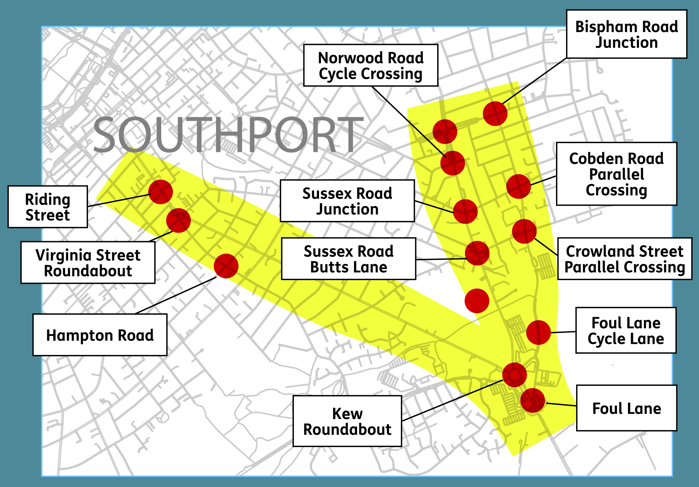
Sefton Council is seeking views from Southport residents and visitors over potential improvements to the town’s key eastern access routes.
The proposed Southport Eastern Access scheme seeks to improve the road, cycling and walking network between the town centre and the Southport Road border in Kew.
Improvements would look to ease congestion issues for motorists, while also seeking to revamp cycling and pedestrian infrastructure at the eastern approach to the town.
The areas within the Southport Eastern Access scheme include:
Kew Roundabout
Southport Road
Foul Lane
Scarisbrick New Road
Norwood Road
More information in the survey: yourseftonyoursay.sefton.gov.uk/investment-programmes-and-infrastructure/southport-eastern-access-improvements
End date of consultation: 20 June 2022
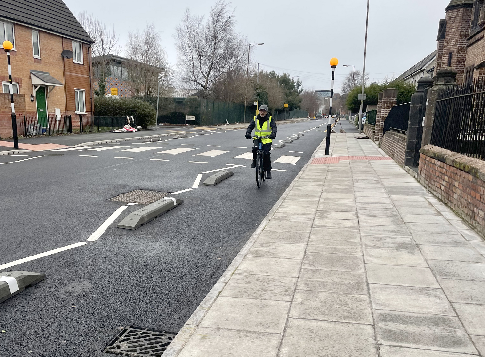
Kingsley Road has been made one-way for motor vehicles, with segregated cycle lanes in both directions.
Formalised car parking areas have been created, avoiding parking obstructions in the cycle lanes.
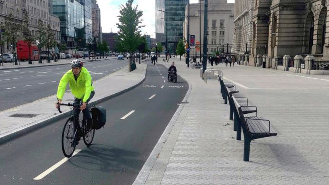
The cycle lane provides safe segregation for cyclists, connecting the route with Princes Avenue Boulevard to the south and Crown Street/Oxford Street to the north.
This has been well implemented, fill in the consultation to keep this in place.
St Helens Borough Council have recently commissioned City Science alongside Civic Engineers last December to produce a Local Cycling and Walking Infrastructure Plan (LCWIP) for the Borough. This will be the first local Borough LCWIP following on from the strategic Liverpool City Region LCWIP, originally produced in 2018.
The LCWIP will cover all of the St Helens Borough, however, will focus on identifying proposals aimed at improving active travel connectivity between the key settlements and communities of St Helens, Blackbrook & Haydock, Newton-le-Willows & Earlestown, Rainford, Billinge, Garswood and Rainhill. It will also focus on connecting local routes with the proposed strategic routes identified in the Liverpool City Region LCWIP. The programme of the St Helens LCWIP will run until around September 2022 and will include a public consultation process in early Summer on draft network proposals.
As part of the initial Evidence Base (Stage 2) process, City Science have asked for members of the forum to input into a 5-minute online survey (available from this link) to collate some of the key network-wide opportunities and constraints. Please note that this survey needs to have been completed by March 9th at the latest.
They are also running an in-person site visit event on Wednesday 2nd March 2022 and would welcome people coming along to this as part of a walk or cycle to experience the network across the Borough. If you are interested in attending this, please contact City Science directly via email (Elliot.reid@cityscience.com).
If you live near, work in, or visit the Lodge Lane area, please complete the Sustrans survey and get involved in this project.
https://www.by-ours-lodgelane.org.uk/
This is a long survey, but it is worth filling in questions 25-26 as you can add lots of comments regarding cycling facilities etc in the free text boxes there
Ends 27 February 2022
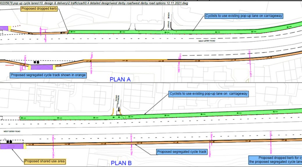
Liverpool City Council has a proposal for a temporary cycle route on West Derby Road, to replace the one previously removed.
Closing date for comments Friday 7th January 2022
https://liverpool.gov.uk/wdrcycling
The consultation is badly designed, with only the options of either agreeing with the plan or disagreeing with it.
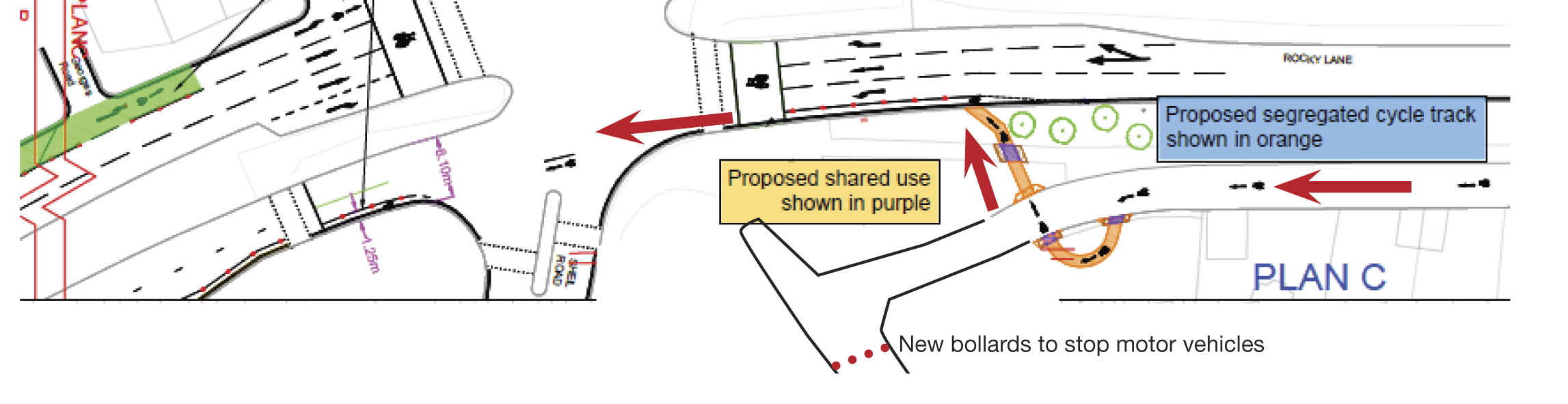
The design for crossing Sheil Road creates dangerous condition for cyclists.
Cyclists join West Derby Road on a cycle lane segregated with wands and into a bike box at the traffic lights.
The width if the cycle lane is not marked, it’s impossible to know if it will be a safe and useable width.
Cyclists are now to the left side of left-turning motor vehicles with obvious potential conflicts. A cyclist carrying straight on is in danger of being hit by a left-turning motor vehicle.
Across the other side of the junction a segregated lane is marked as 1.25m wide, which is below the standard for cycling next to fast moving motor vehicles.
The junction needs dedicated traffic lights for cyclists and a cycle lane of 2m width.
As it stands, the only response to this consultation is to disagree with the creation of this cycle route.
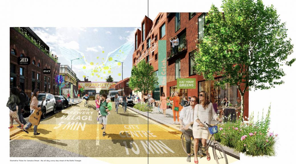
Public consultantion has now begun on the future development of the Baltic Triangle.
The consultation is HERE
There’s also a drop in event on Thursday 20 Feb from 11am-7pm.
Baltic Creative CIC, 49 Jamaica Street, Liverpool L1 0AH